30DayMapChallenge-2022
30DayMapChallenge 2022
My contributions to the #30DayMapChallenge in 2022
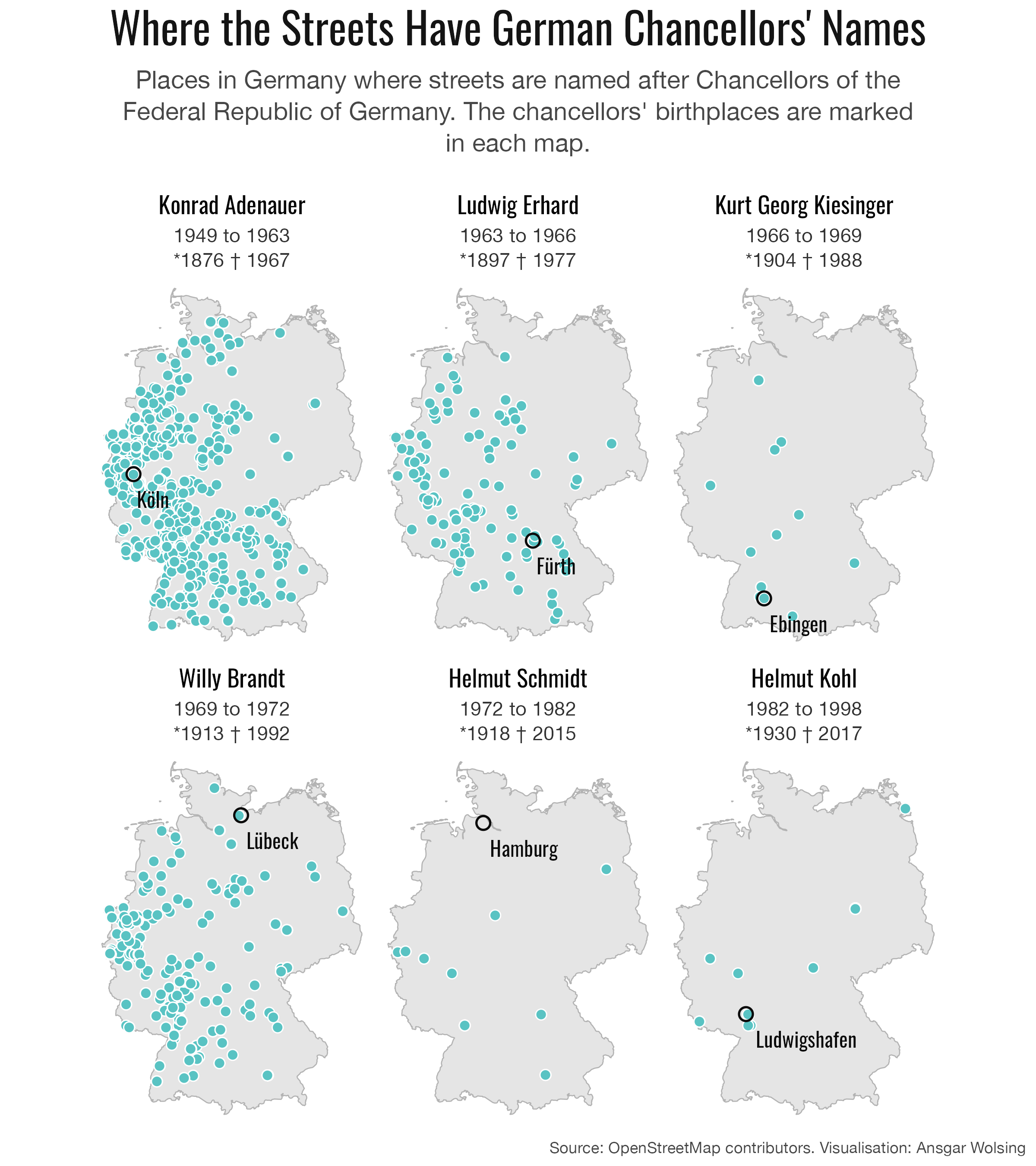
01 | Points
Where the Streets have German Chancellors’ Names
Towns in 🇩🇪 where streets are named after Chancellors of the Federal Republic of Germany.
(To be fixed: Location of Hamburg)
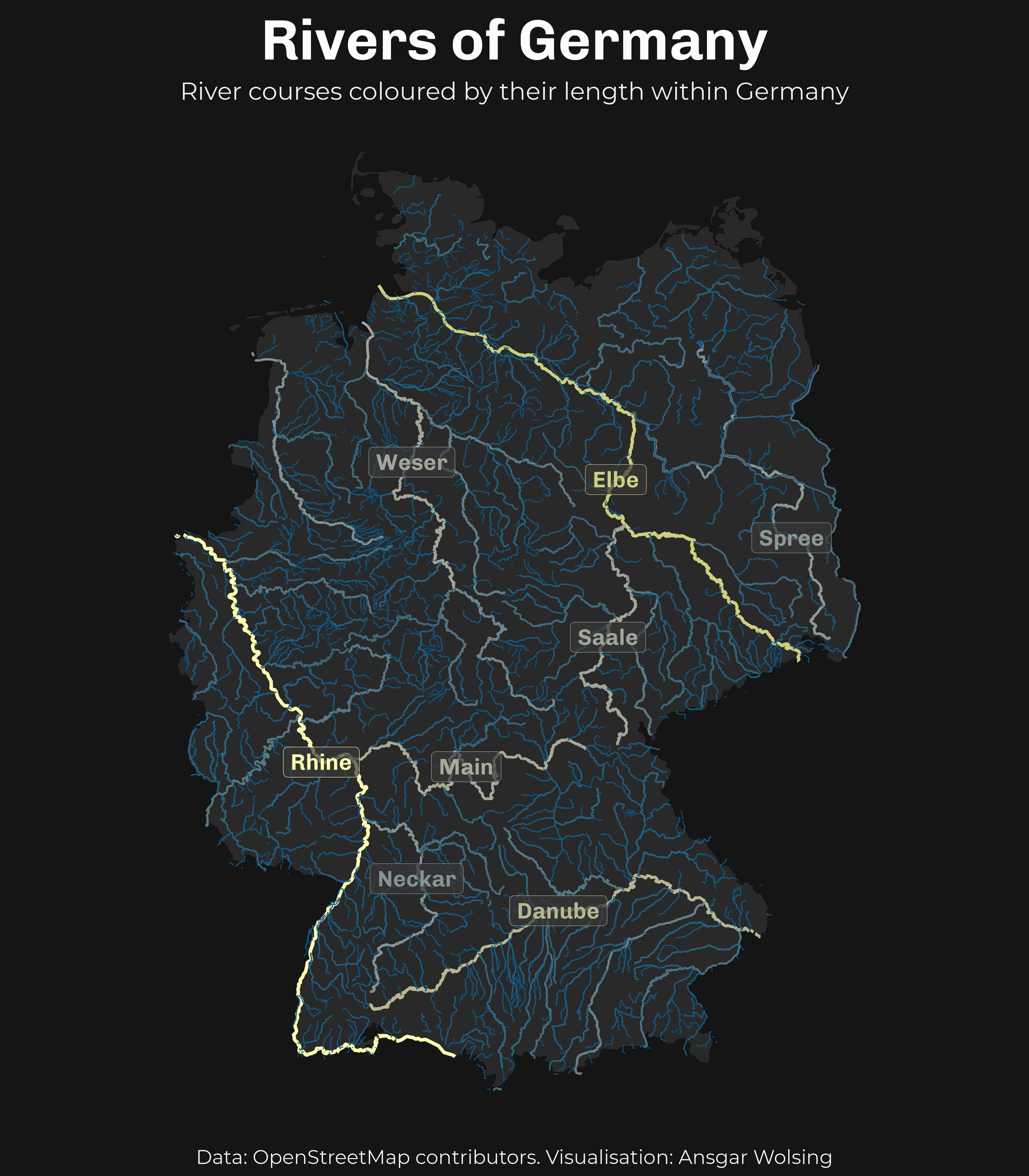
02 | Lines
Rivers of Germany
River courses coloured by their length within Germany. (i.e. the Rhine has the longest course within Germany, while the Danube is the longest river flowing through Germany overall.)
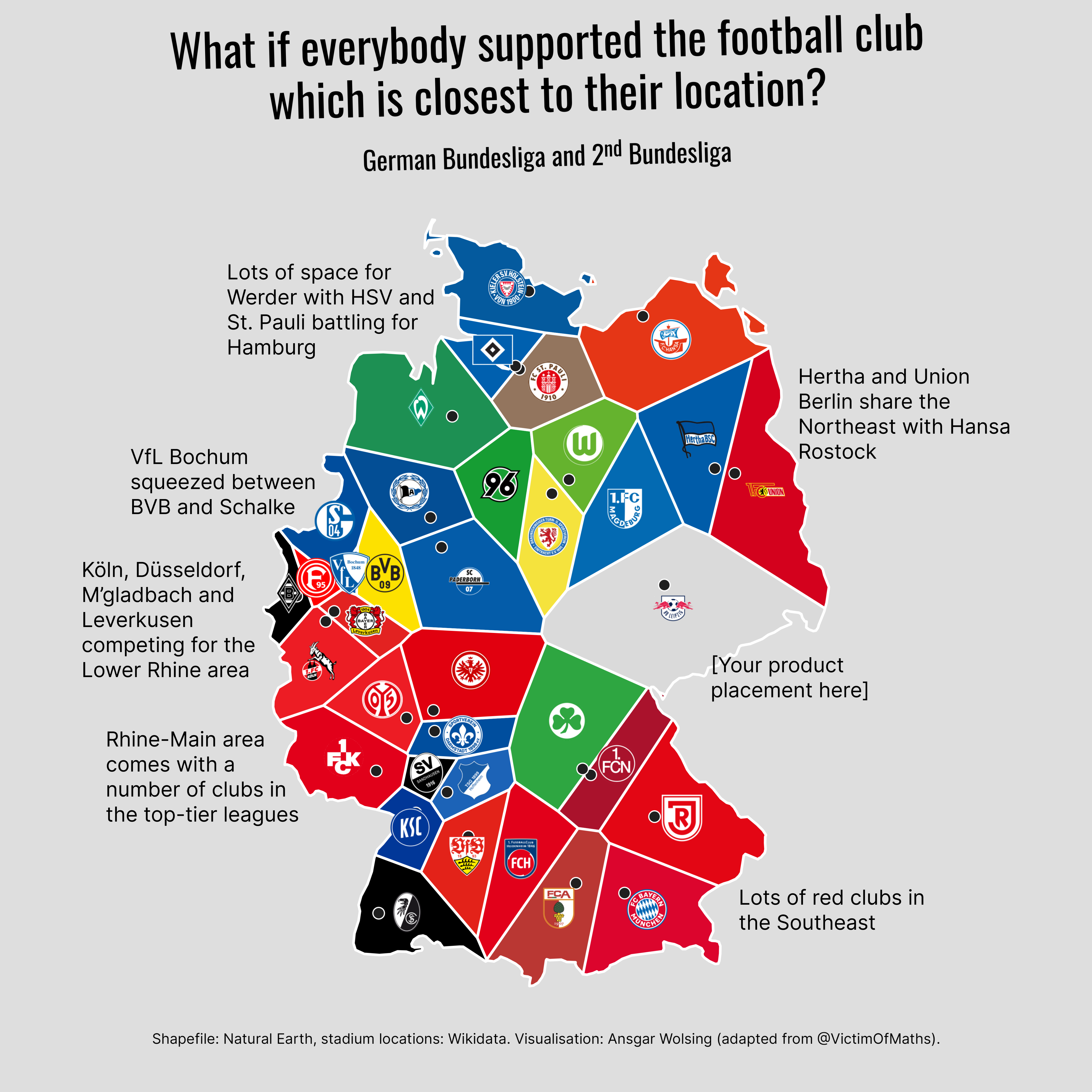
03 | Polygons
What if everybody in Germany supported the nearest football club?
Voronoi polygons show the area where every point is closest to a particular stadium of Bundesliga + 2nd division.
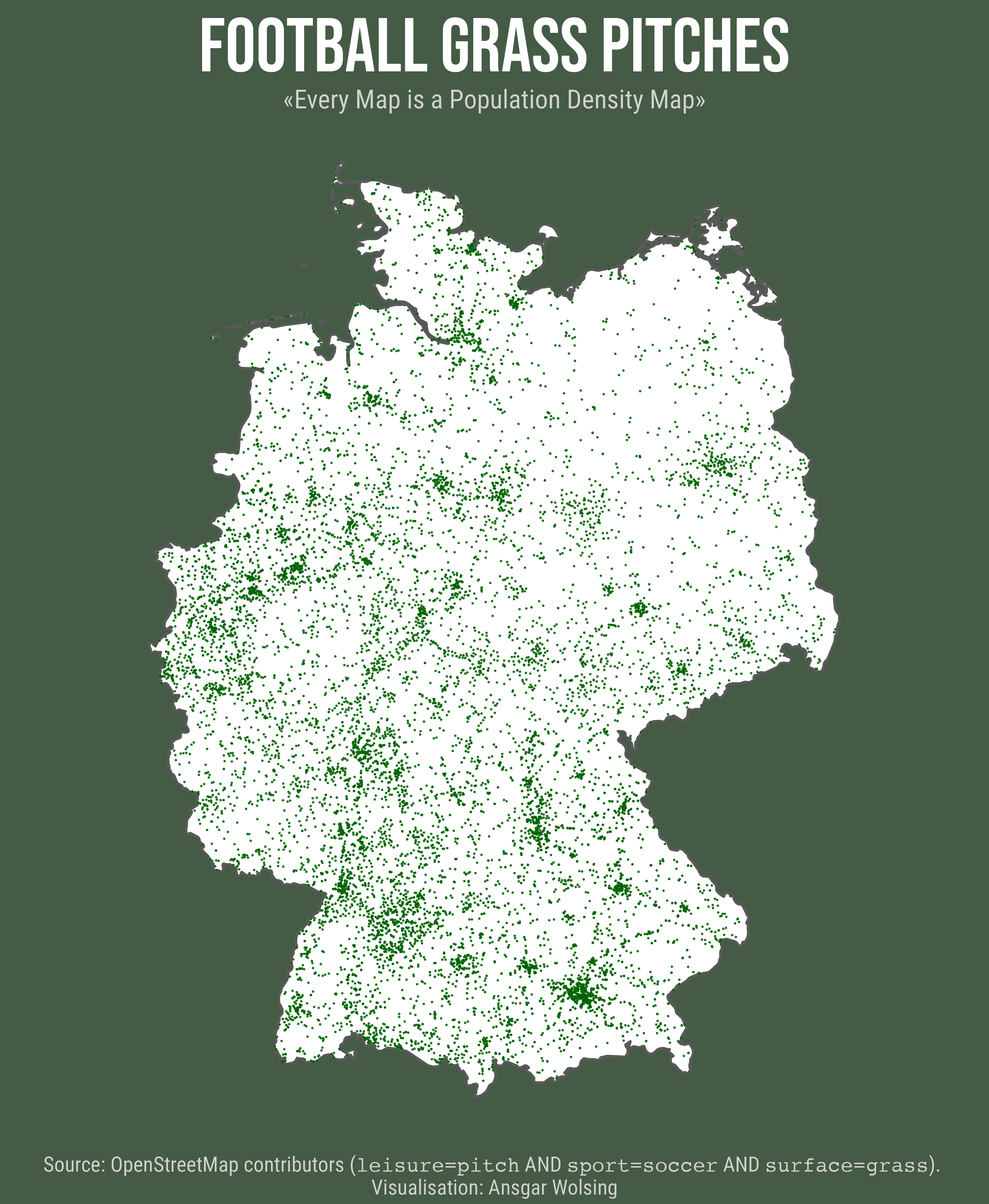
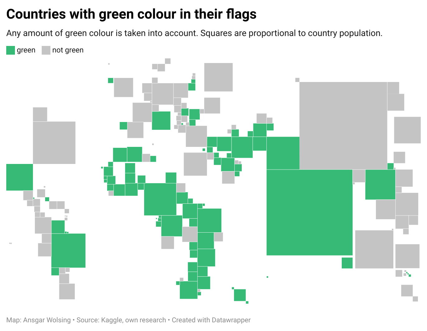
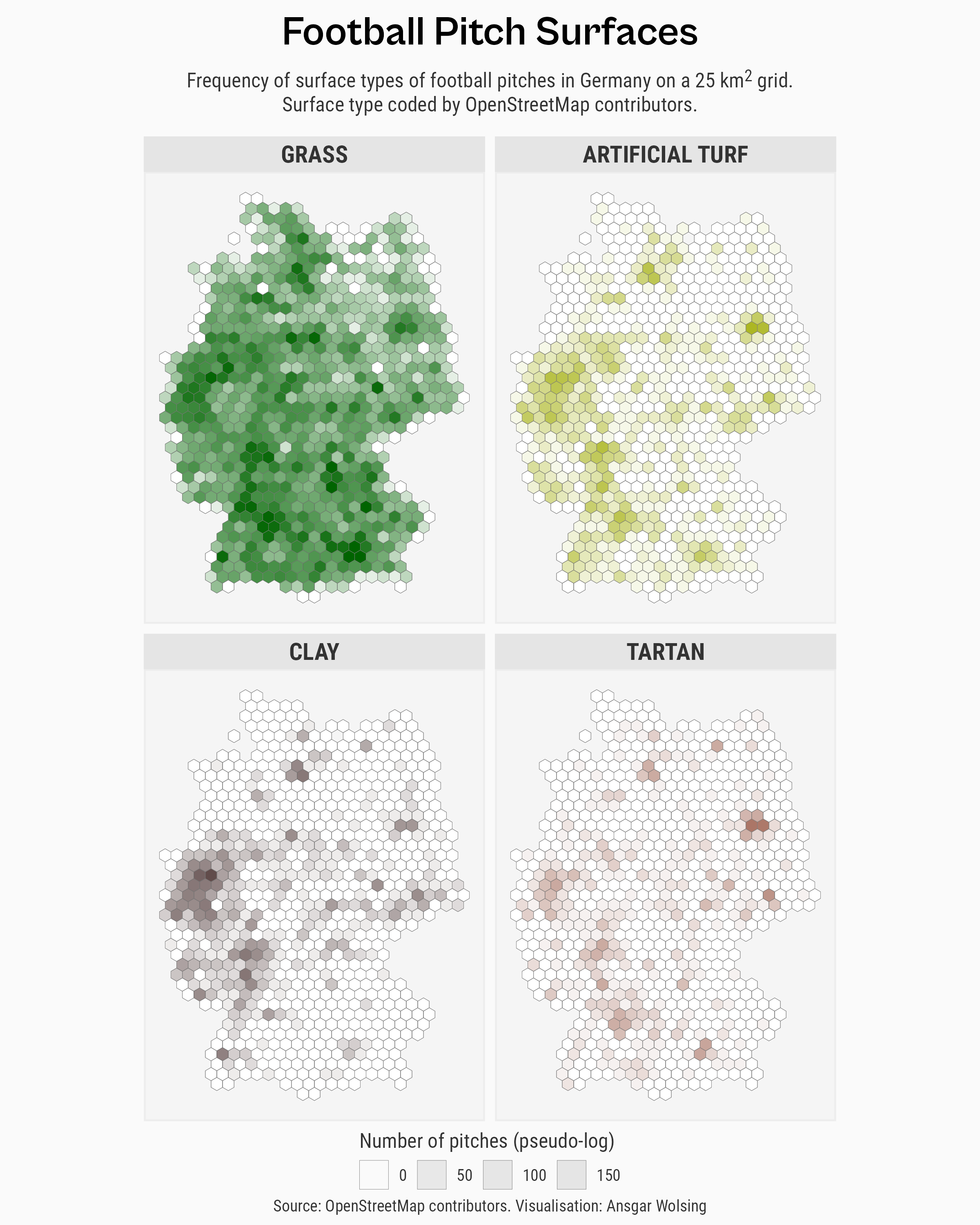
04 | Colour Friday: Green
Football grass pitches in Germany
Countries with green colour in their flags
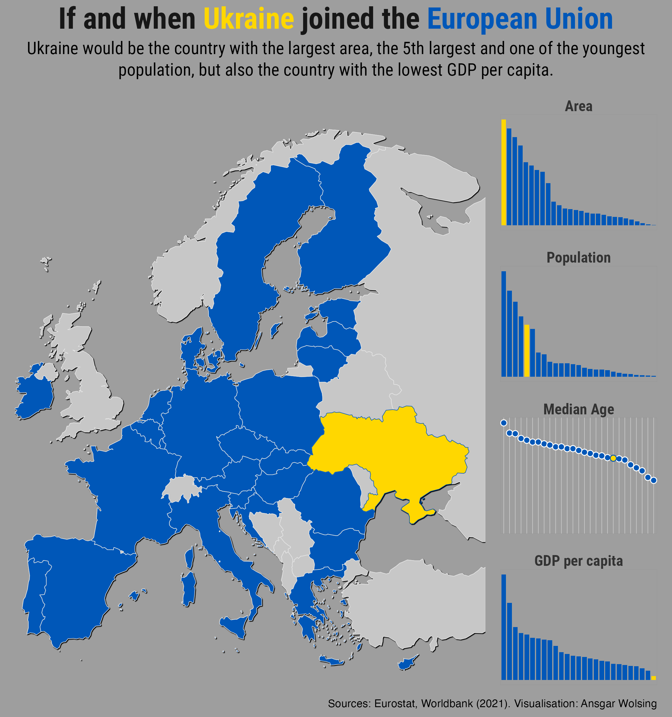
05 | Ukraine
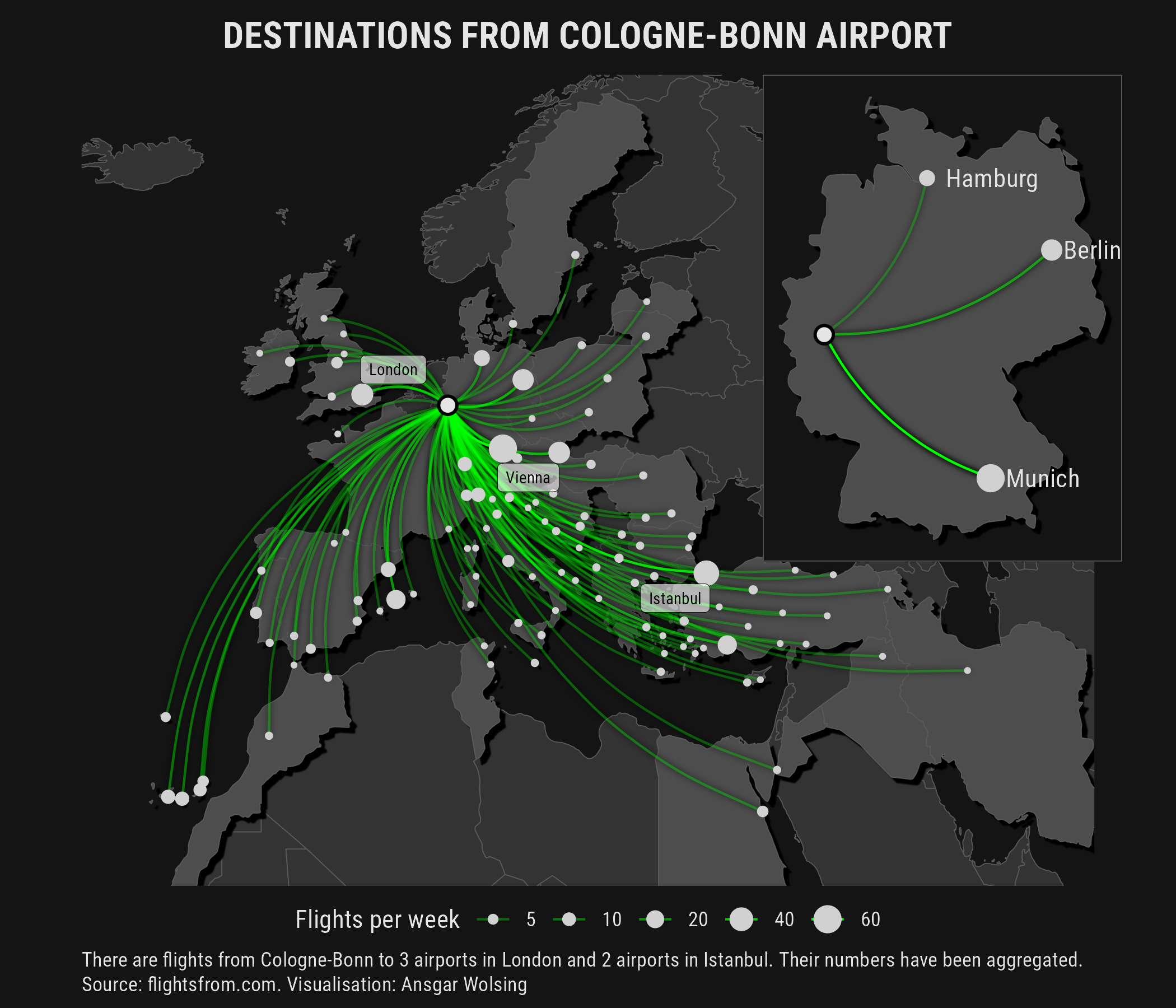
06 | Network
07 | Raster
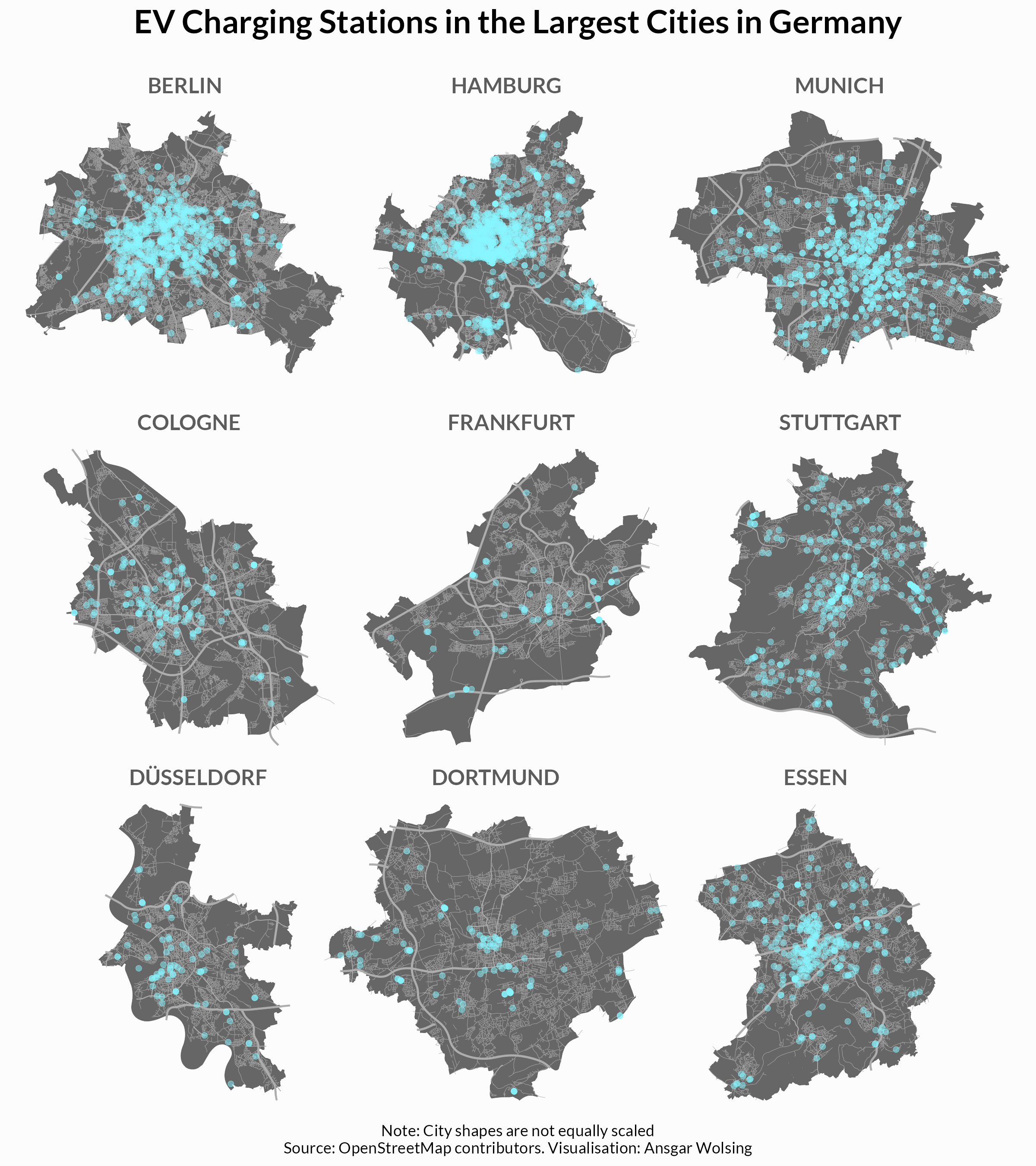
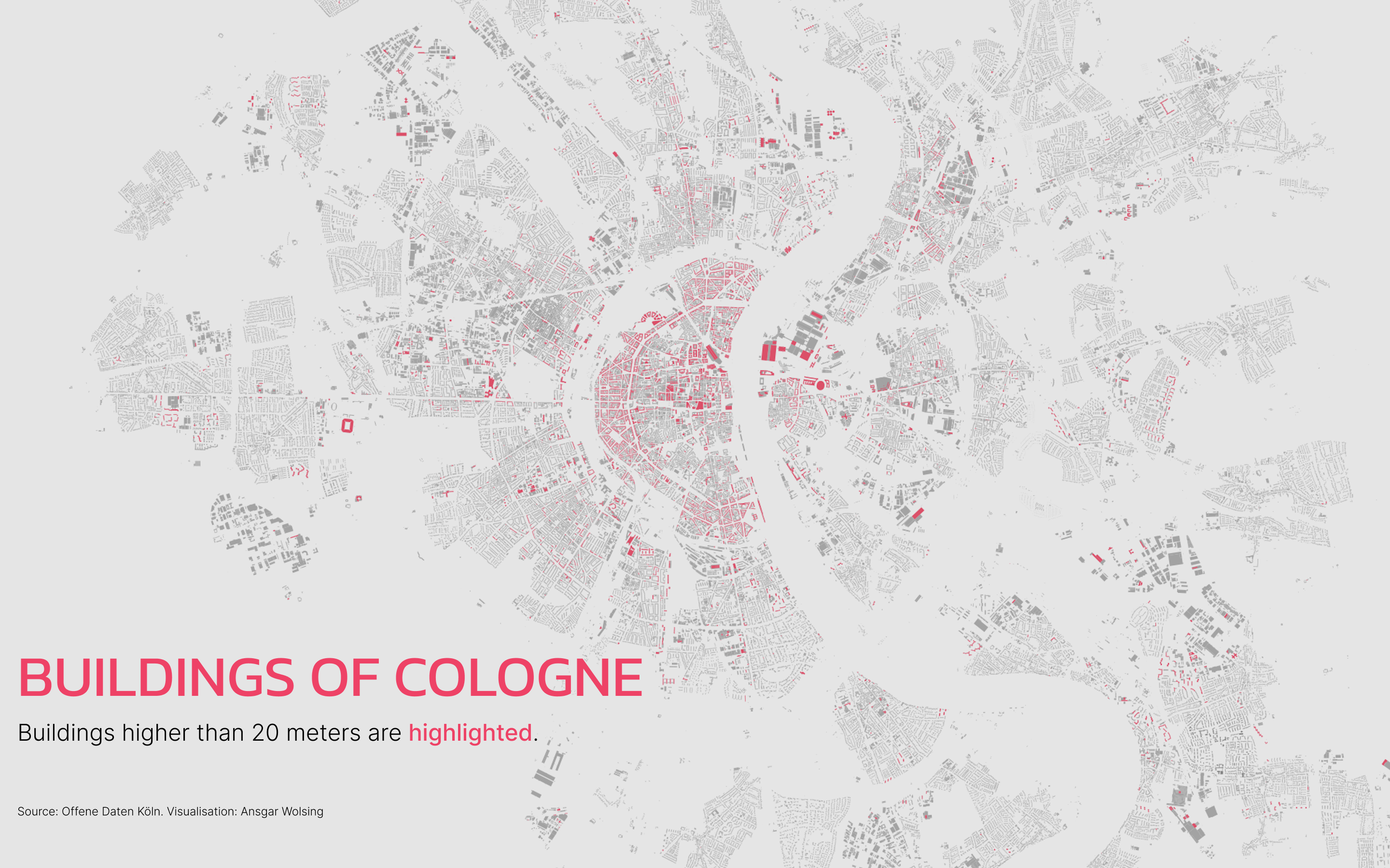
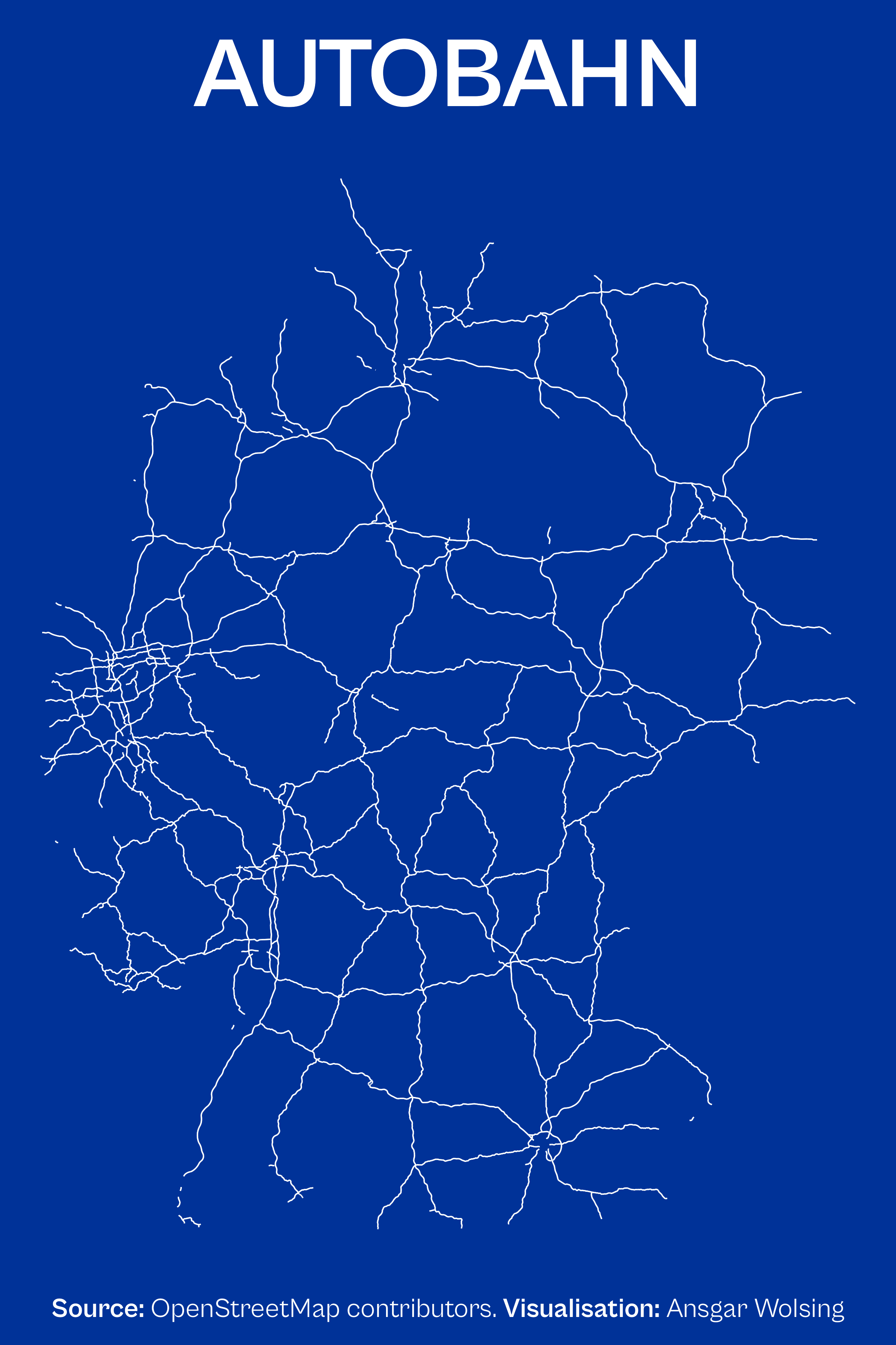
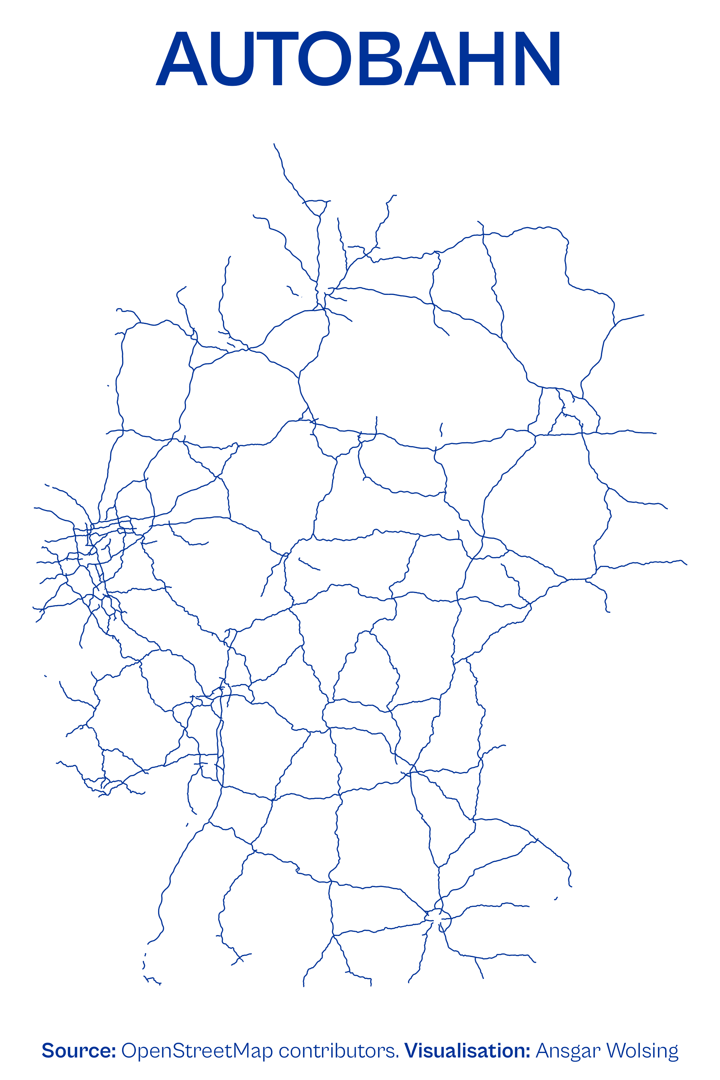
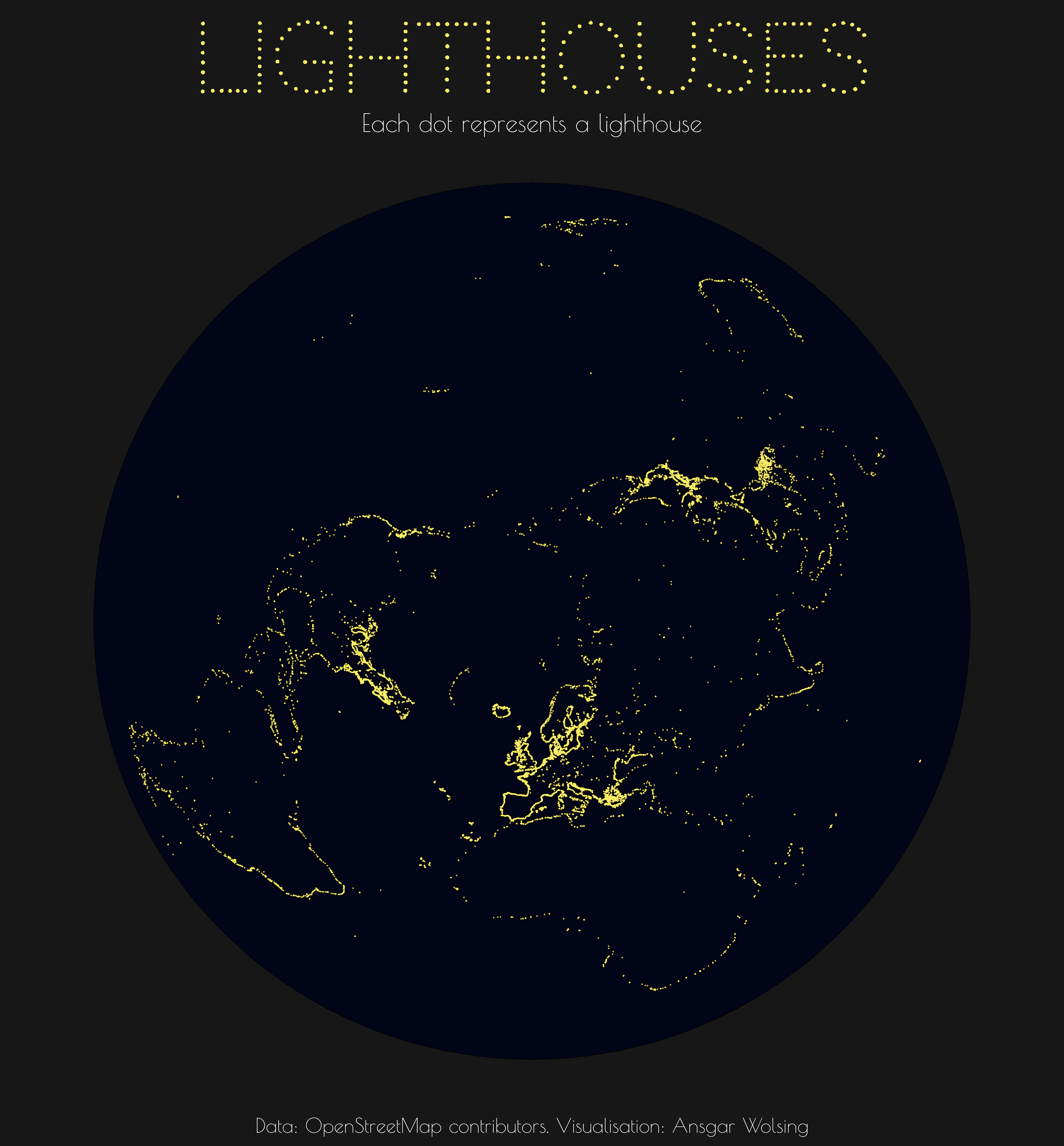
08 | Data: OpenStreetMap
10 | Bad Map
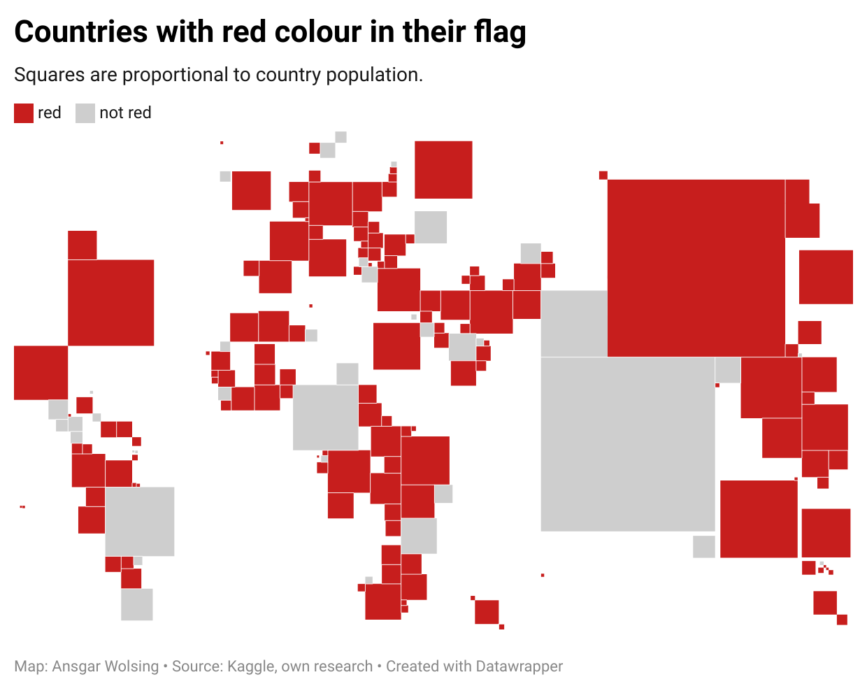
11 | Colour Friday: Red
12 | Scale
13 | 5-minute Map
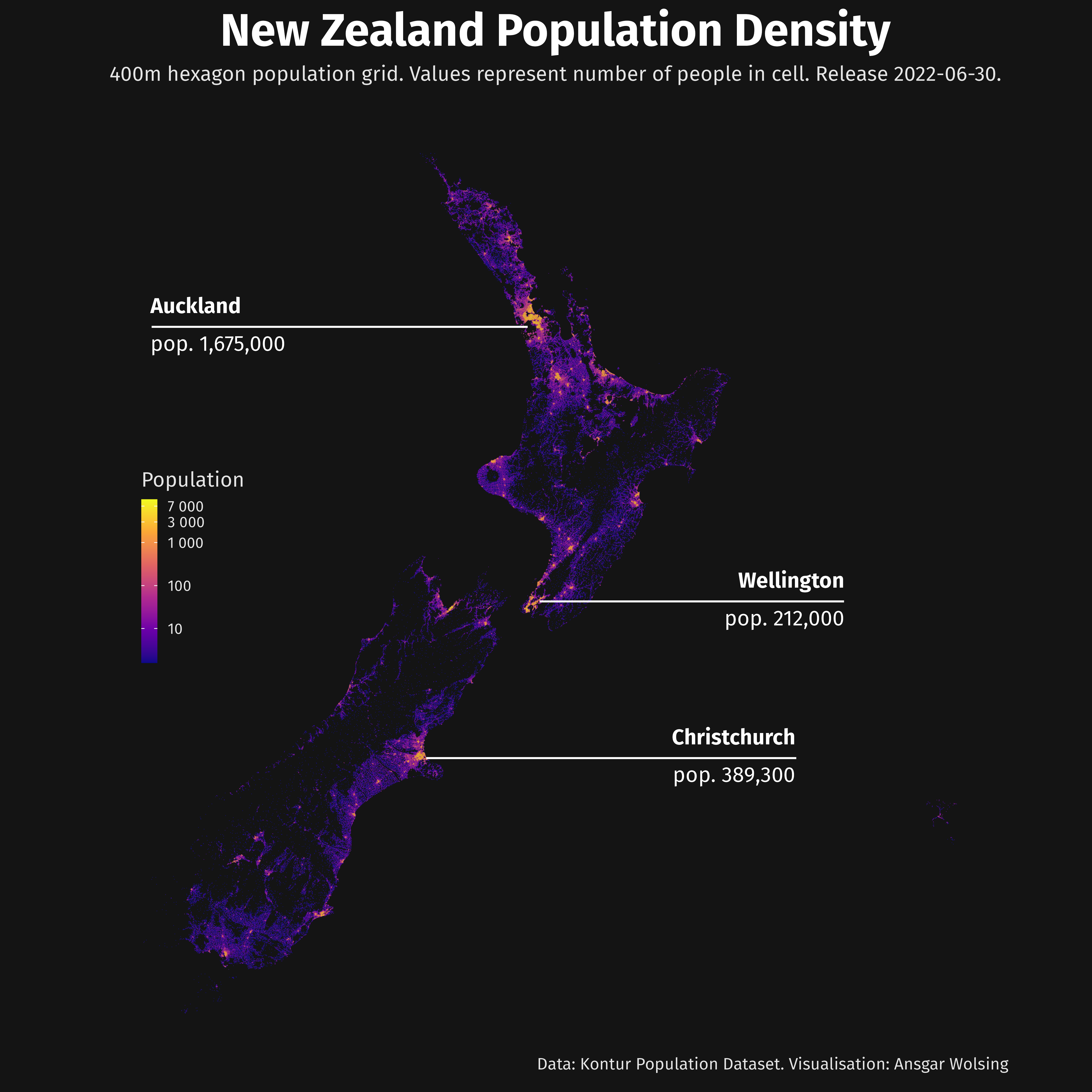
14 | Hexagons
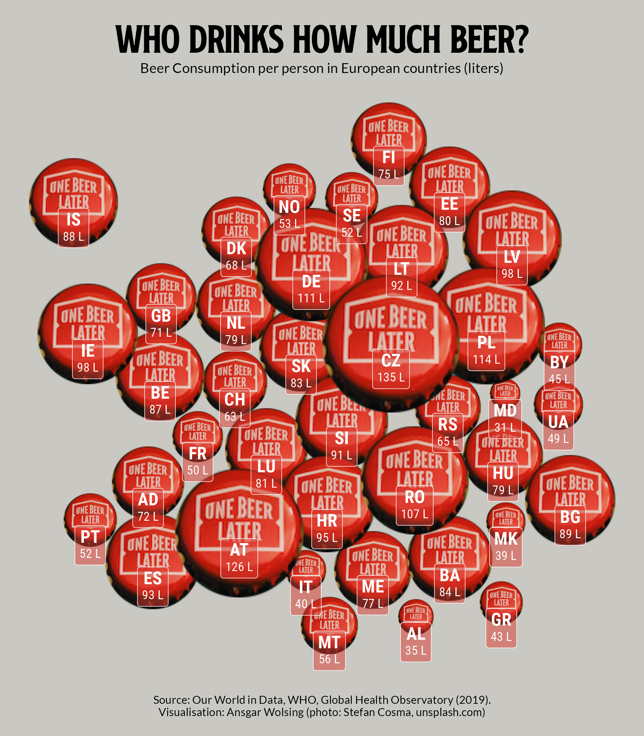
15 | Food/Drinks
16 | Minimal
18 | Colour Friday: Blue

19 | Globe
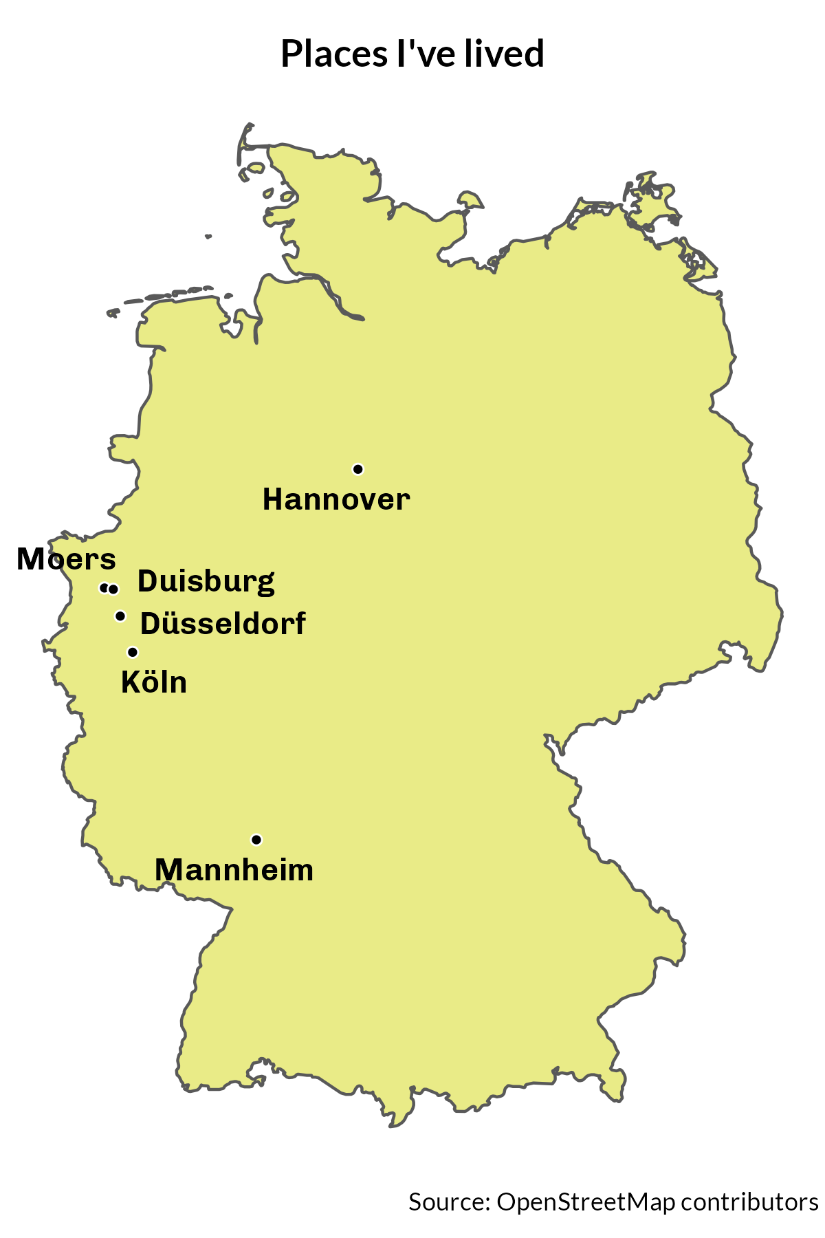
20 | My Favourite…

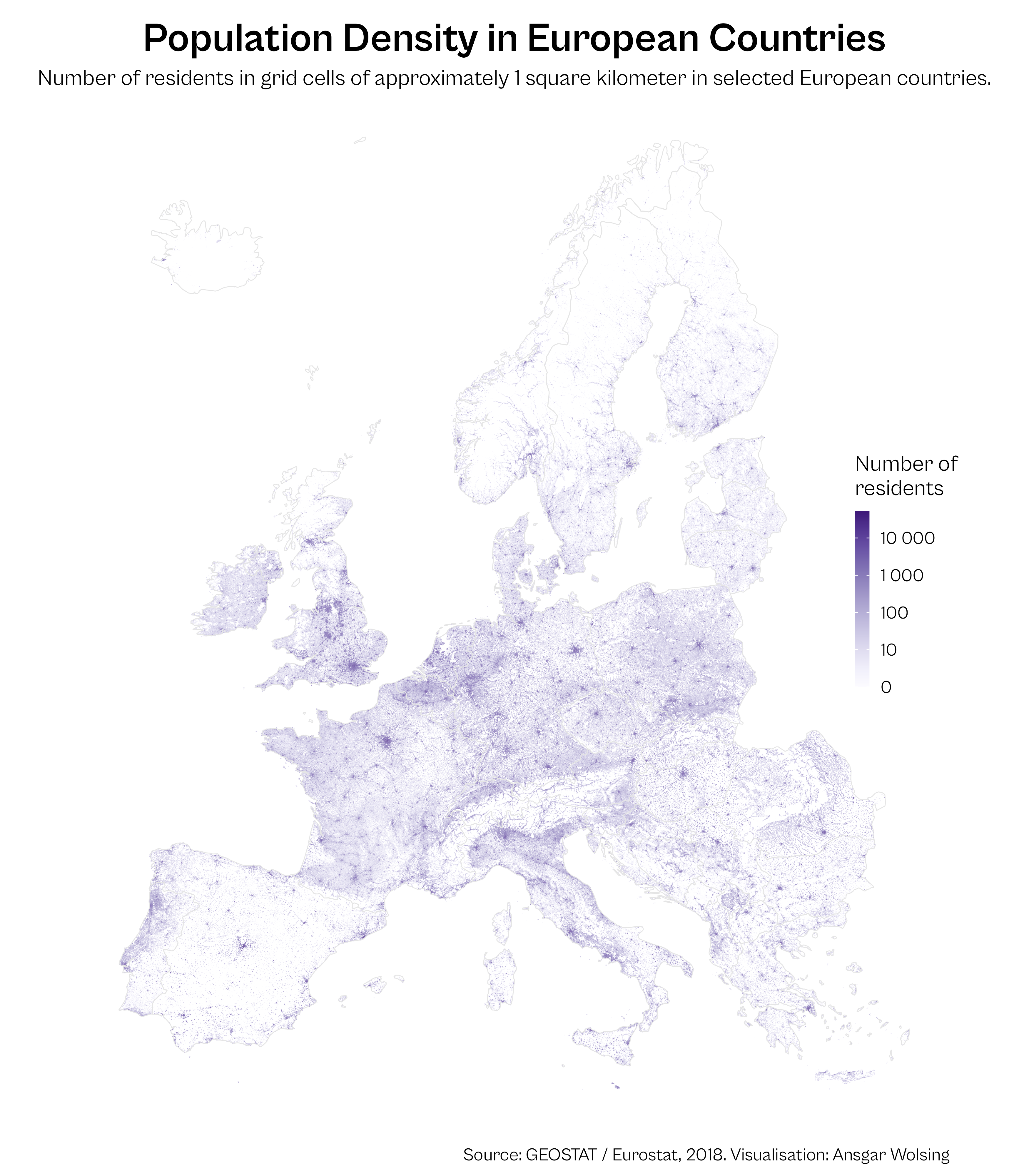
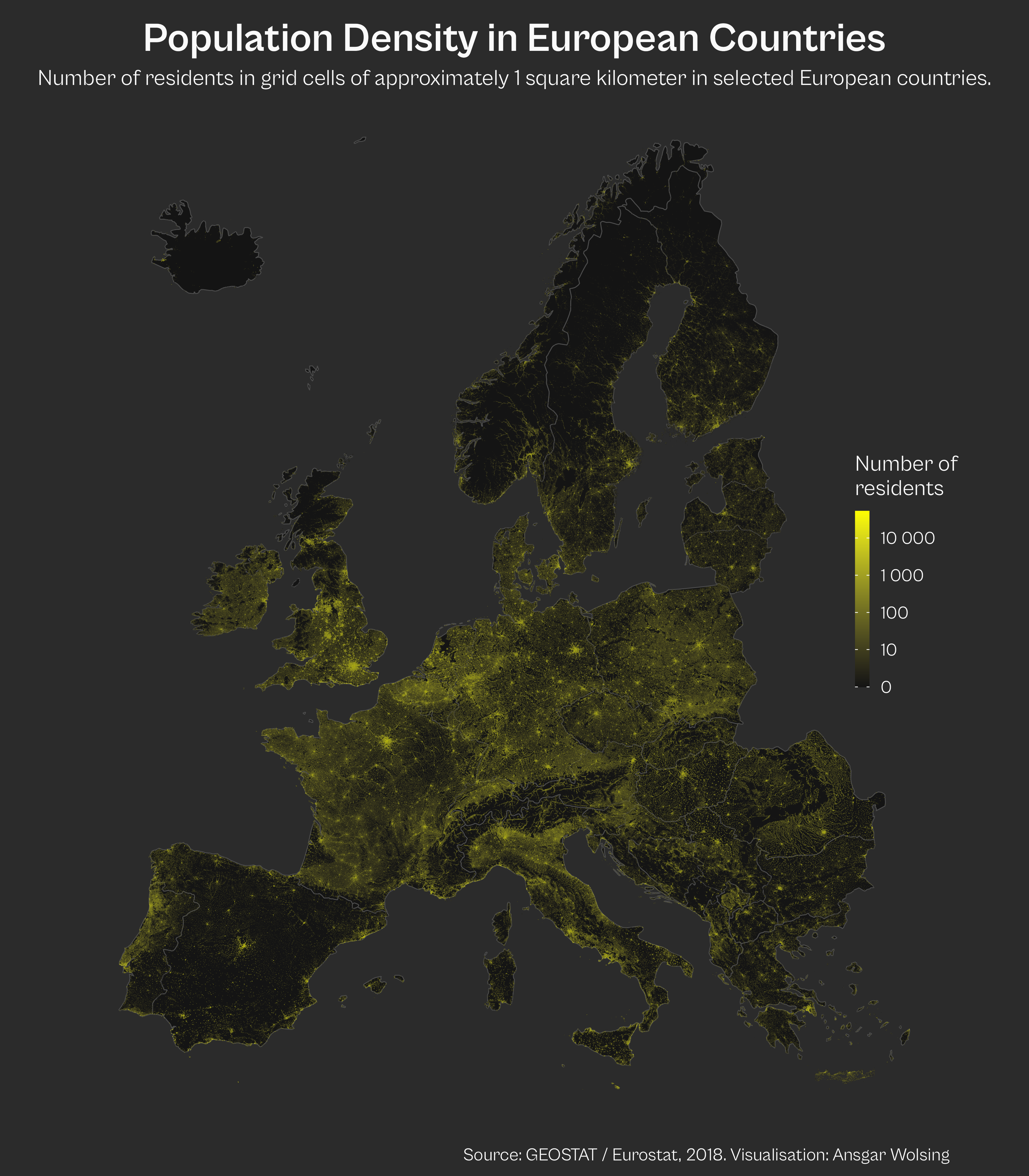
21 | Data: Kontur Population Dataset
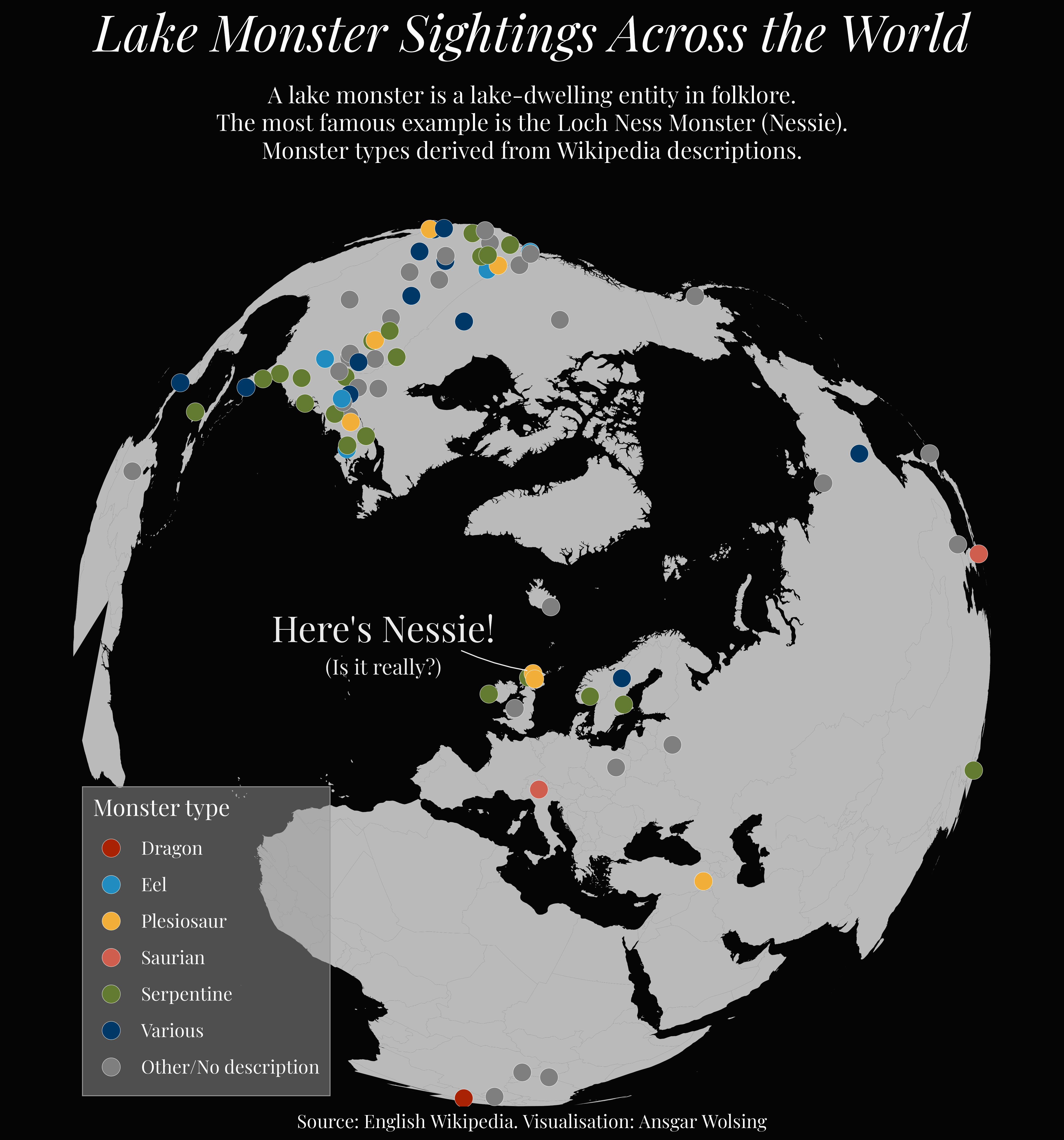
24 | Fantasy
25 | Colour Friday: 2 Colours
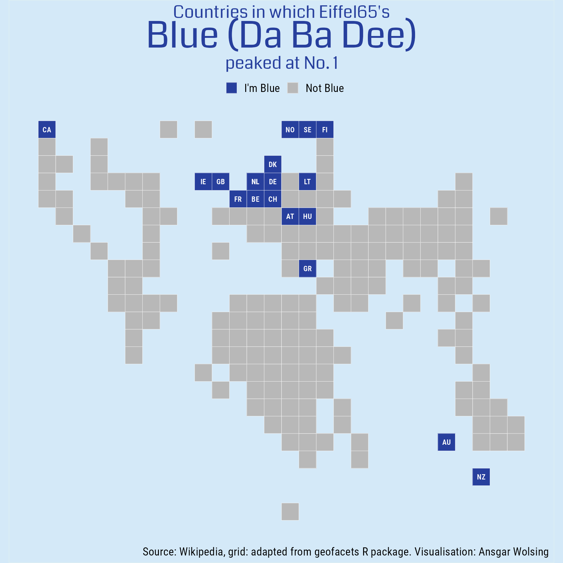
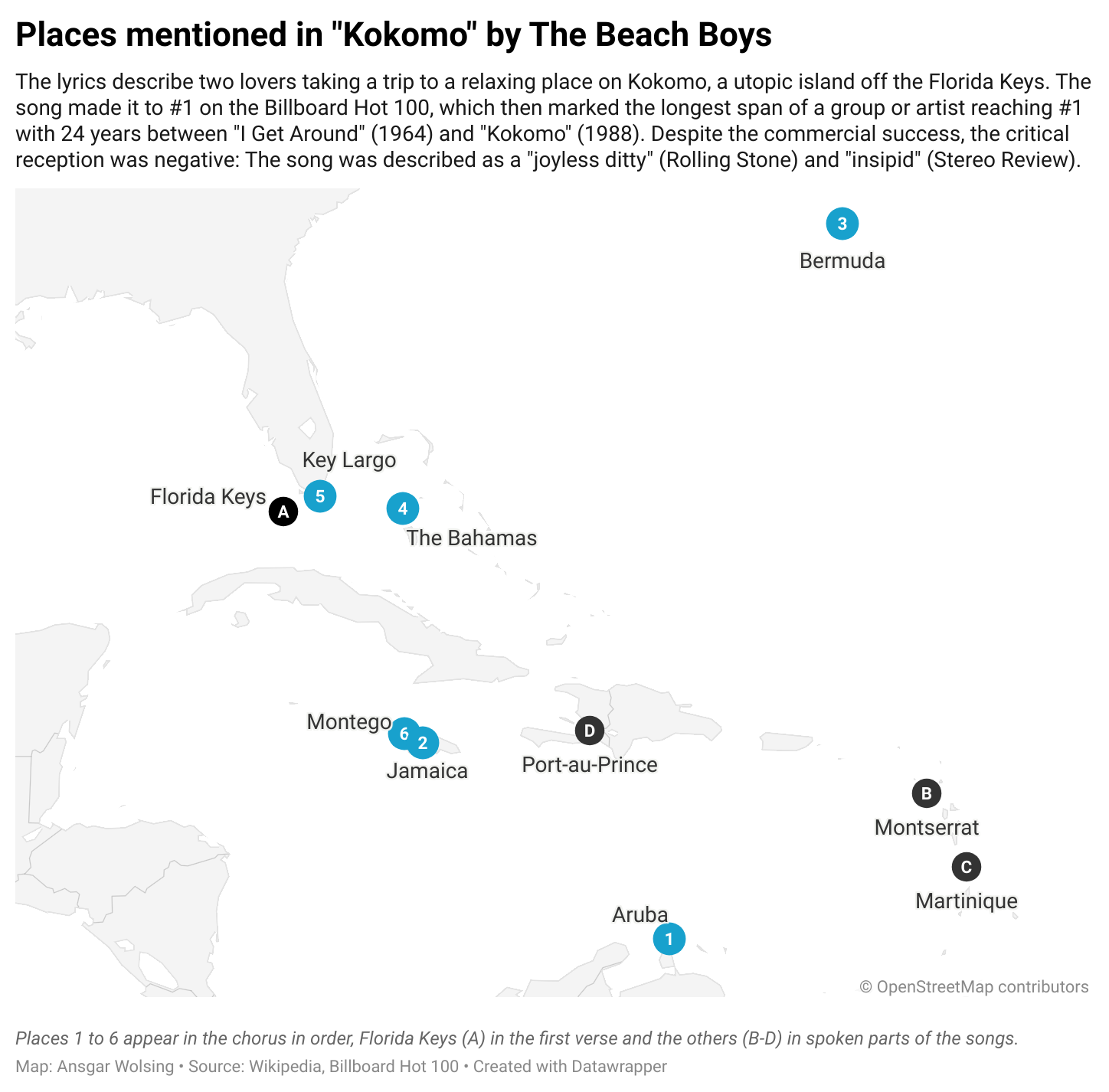
27 | Music
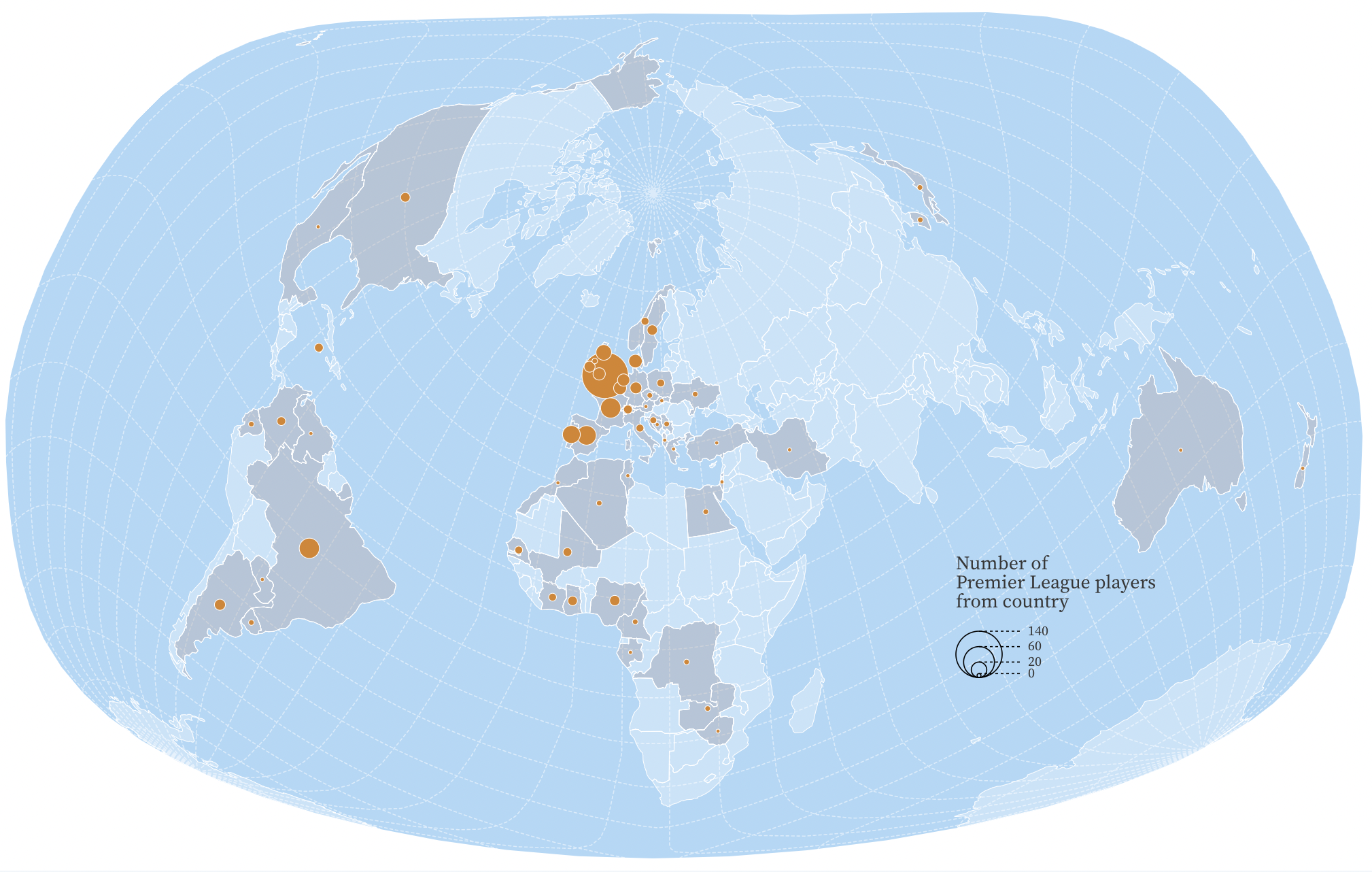
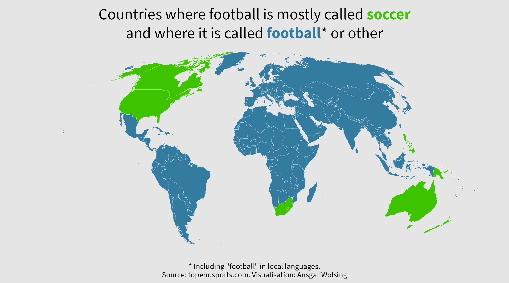
29 | Out Of My Comfort Zone
First time using Observable to create a map of nationalities of Premier League players: https://observablehq.com/d/22f5c68721b716a7